Copyright 2026 © swekartor. All Rights Reserved.

Information about Moultrie
App Feature
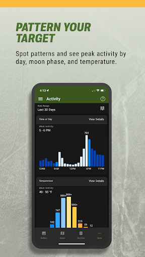
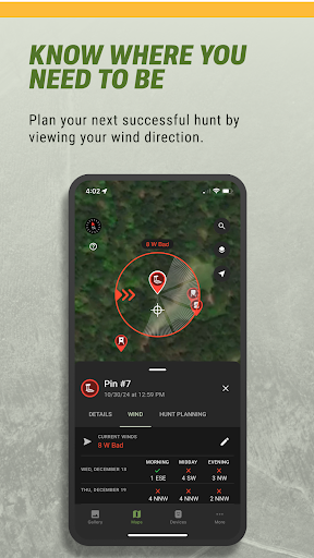
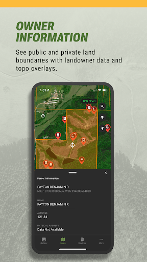
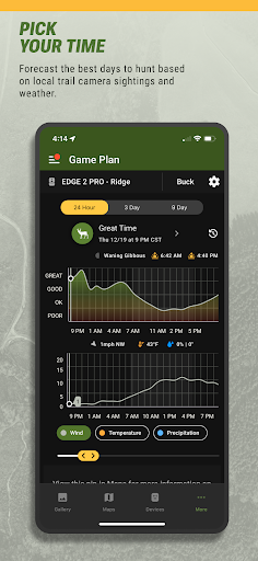
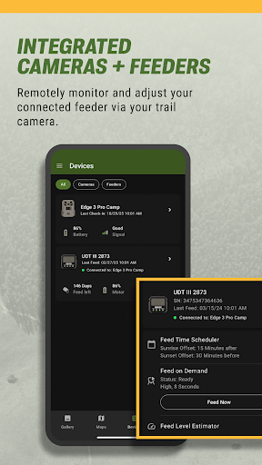
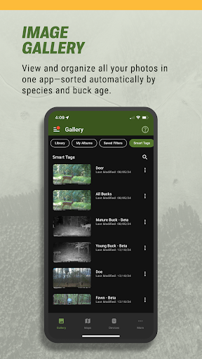
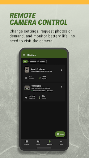
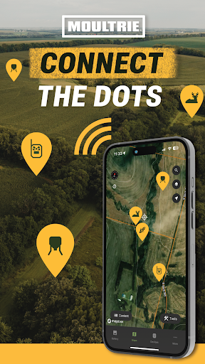
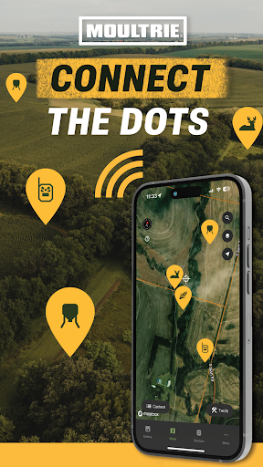
Moultrie connects hunters to their trail cameras and feeders, centralizing photo management, remote camera control, smart image tagging, activity charts, weather and wind insights, interactive maps, and optional advanced planning tools (topo/property lines, ideal wind, deer movement forecasts).
Verdict
Verdict: A capable companion for Moultrie gear with strong scouting tools, but reliability and ecosystem lock-in may frustrate non-Moultrie users.
Who is it for
Best for:
- Hunters using Moultrie cellular cameras or connected feeders who want remote control and alerts
- Users seeking automated image tagging, activity charts, and weather-integrated planning
- Land managers coordinating shared galleries across leases or properties
Not ideal for:
- People without Moultrie hardware who primarily want cross-brand camera support
- Users wanting the most robust offline maps/land ownership tools without a paid upgrade
- Anyone intolerant of potential sync/connectivity hiccups typical of cellular trail cams
Real-world User Experience
Users like it:
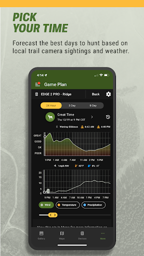
Clean navigation, quick access to galleries, and helpful smart tags that identify species and sort bucks by age. Remote camera setting changes, on-demand photos/videos, and timely notifications are praised when connections are strong. Activity charts, weather overlays, and shared galleries add practical value during scouting and season prep.
Users complain about:
Reports of occasional connectivity delays, failed syncs, or spotty notifications—often tied to signal or power conditions. Some mention app glitches after updates, and frustration with subscription prompts for advanced mapping/forecast features. Battery/solar reporting and feeder status can lag or be inconsistent for a minority of users.
Is it Worth Paying For?
The core app is free and useful (maps, library, smart tags, charts). The Hunt Planning Plus upgrade adds topo maps, property lines, ideal wind, and movement forecasts—worth it for serious hunters optimizing stand access and timing, especially if already invested in Moultrie cameras. Casual users or those on a single small property can likely stay on the free tier.
How it Compares to Alternatives
Compared to Spypoint, Tactacam Reveal, or Bushnell apps, Moultrie stands out with integrated smart tagging and solid activity analytics, but reliability is similar and depends on cell coverage and hardware health. Versus dedicated mapping apps like HuntStand or onX Hunt, Moultrie’s free maps are lighter; its paid topo/property lines narrow the gap but onX/HuntStand still lead for deep land/parcel tooling. If you own Moultrie hardware, this app offers the smoothest end-to-end experience; for mixed-brand camera fleets, broader platforms may fit better.
Summary
Moultrie is a well-rounded hunting and scouting app that shines when paired with Moultrie cameras and feeders. It centralizes photo management and adds meaningful intelligence—smart species/age tagging, activity charts, weather and wind—so planning is faster and more data-driven. The free tools are genuinely useful, while the Plus tier brings topo maps, property boundaries, and ideal wind forecasts that benefit serious hunters. Expect the usual cellular trail cam caveats—occasional sync delays, notification hiccups, and reliance on signal and power. If your gear is in the Moultrie ecosystem, this app is a strong hub; if you prioritize best-in-class maps or run mixed-brand hardware, consider complementing or comparing with alternatives.
Ratings
Trending APP


Alternative to this app