Copyright 2026 © swekartor. All Rights Reserved.

Information about onX Hunt: Offline Hunting Maps
App Feature
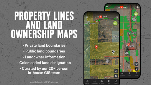
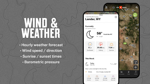
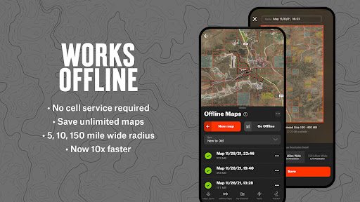
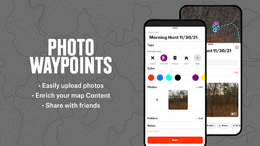
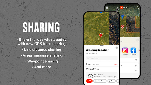
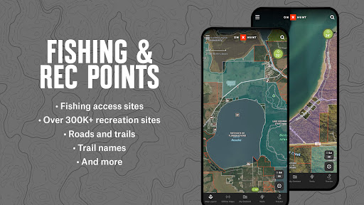
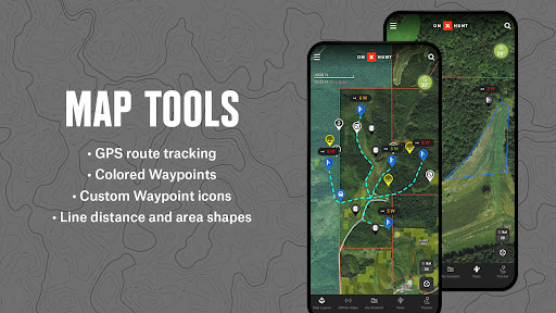
onX Hunt is a hunting and outdoor navigation app focused on accurate offline maps, private/public land boundaries with owner names (U.S.), 3D/LiDAR topo and satellite basemaps, GPS tracking with waypoints and tracks, state-specific hunting units and layers, localized weather, and integrations like Android Auto, Wear OS, trail cameras, and compatible rangefinders/binoculars.
Verdict
Verdict: A powerful, data-rich hunting map and navigation tool that excels offline, though subscriptions and occasional stability issues may deter casual users.
Who is it for
Best for:
- Hunters needing reliable offline maps, land boundaries, and unit layers
- Outdoorspeople (foragers, hikers, ranch/range workers) who track routes and mark waypoints
- Planners who want 3D/LiDAR terrain analysis and gear integrations
Not ideal for:
- Casual users who won’t benefit from paid layers or multi-state coverage
- Those who need flawless app stability during peak season updates
- Users in counties with sparse private landowner data coverage
Real-world User Experience
Users like it:
Highly accurate offline GPS and mapping; up-to-date landowner info; excellent for scouting, access points, resolving property lines, and non-hunting use (foraging, hiking, work). Waypoints/tracks are easy to save and revisit. 3D/topo layers aid terrain understanding. Customer support is prompt and helpful; refunds and bug fixes reported.
Users complain about:
Occasional crashes/lag—especially after updates—and tracker sometimes draws straight lines when the phone is pocketed. Some forest roads unlabeled and occasional property data inaccuracies. Subscription/charging confusion for a few users and landowner coverage gaps in certain counties.
Is it Worth Paying For?
Yes for active hunters and serious outdoor users: the Premium/Premium+/Elite tiers unlock statewide or multi-state ownership layers, hunting units, and robust offline capabilities that materially improve scouting and navigation. A 7‑day free trial helps assess value. If you only need basic mapping infrequently, the subscription may feel unnecessary.
How it Compares to Alternatives
Compared to general-purpose map apps, onX Hunt offers far superior land ownership boundaries, hunting units, and hunting-specific layers, plus stronger offline reliability. Versus other hunting map tools, user feedback highlights particularly accurate ownership data, responsive support, and strong integrations (Android Auto, wearables, cameras), though it shares the category’s tradeoffs of subscription cost and occasional data/stability hiccups.
Summary
onX Hunt: Offline Hunting Maps combines trustworthy offline GPS navigation with detailed private/public land boundaries, hunting unit overlays, and rich 3D/LiDAR basemaps to plan, scout, and execute hunts confidently. Users consistently praise its accuracy, waypoint/track tools, and usefulness beyond hunting, supported by responsive customer service. Some report occasional app instability after updates, tracker quirks when the phone is pocketed, and gaps in road labels or private data in certain areas. With a 7‑day trial and tiered memberships (single or multiple states), it’s a strong value for serious hunters and outdoor professionals, while casual users may prefer sticking to free tools or lighter alternatives.
Ratings
Trending APP


Alternative to this app