Copyright 2026 © swekartor. All Rights Reserved.


App Feature
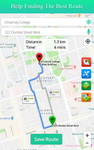
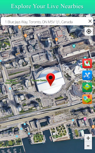
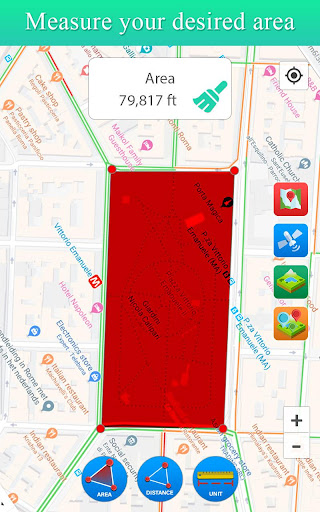
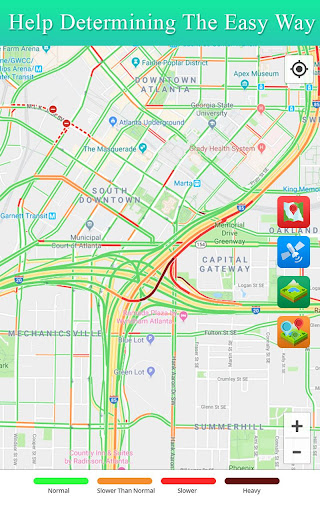
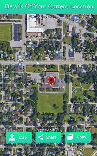
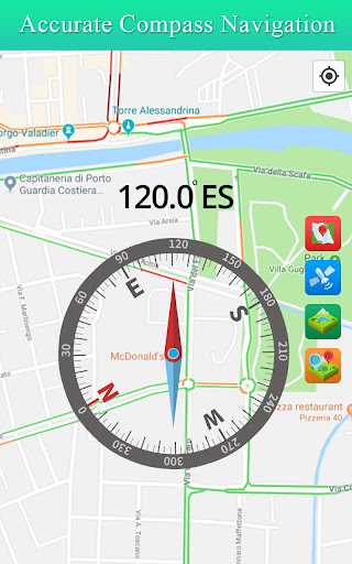
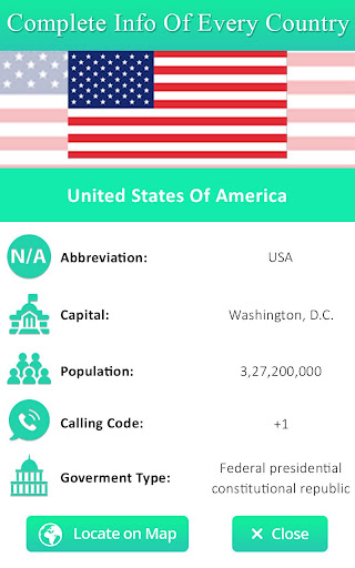
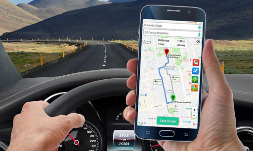
Live Satellite View GPS Map is a free maps and navigation app focused on quick satellite/street views, basic route planning (2D/3D), traffic details, voice guidance, and saving/sharing favorite locations. It promises real-time route info, nearest-place discovery, and simple tools like distance/area measurement.
Verdict
Verdict: A handy satellite-view and basic navigation companion, but weaker than top-tier apps for accuracy, freshness of imagery, and ad experience.
Who is it for
Best for:
- Users who want fast-loading satellite/street views and simple routes
- Casual travelers needing quick POI lookup and basic voice directions
- Drivers who value lightweight tools like distance/area measurement
Not ideal for:
- Users demanding up-to-date satellite imagery and high accuracy
- Daily commuters needing robust traffic rerouting and reliability
- Anyone sensitive to frequent ads or expecting truly live satellite feeds
Real-world User Experience
Users like it:
Quick-loading and clear satellite views; finds locations accurately enough for many; simple, easy-to-use navigation; helpful for drivers and travelers; smooth UI for most, with useful features like distance/area measurement and POI discovery.
Users complain about:
Frequent, intrusive ads; satellite imagery not truly live and can be outdated; occasional location inaccuracies and lag; requests for better POI labeling/announcements; some users expected Google-Earth-level recency and were disappointed.
Is it Worth Paying For?
The app is free with ads and offers IAPs (likely to remove ads/unlock features). Given the ad intrusiveness, paying to remove ads could be worthwhile if you like the interface and quick satellite loading. If you need top-tier accuracy and traffic features, free alternatives may offer better value without paying.
How it Compares to Alternatives
Compared to Google Maps and Waze, it provides simpler routing and traffic info with less robust data, fewer real-time community reports, and weaker rerouting. Versus Google Earth, some users find it loads satellite tiles faster but the imagery is less current. It’s more of a lightweight viewer/navigator than a full replacement for established navigation leaders.
Summary
Live Satellite View GPS Map aims to blend quick satellite/street views with basic navigation, traffic details, voice guidance, and POI discovery. Users praise its fast map loading, clarity, and straightforward tools, making it useful for casual navigation and exploration. However, the experience is held back by frequent ads, occasionally outdated imagery, and accuracy concerns. If you want a lightweight way to check satellite views and get simple routes, it’s a decent companion. For frequent commuting or the most reliable, up-to-date mapping and traffic, Google Maps/Waze or Google Earth will likely serve you better.
Ratings
Trending APP


Alternative to this app