Copyright 2026 © swekartor. All Rights Reserved.


App Feature
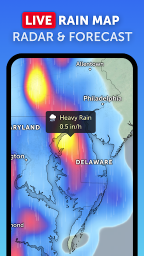
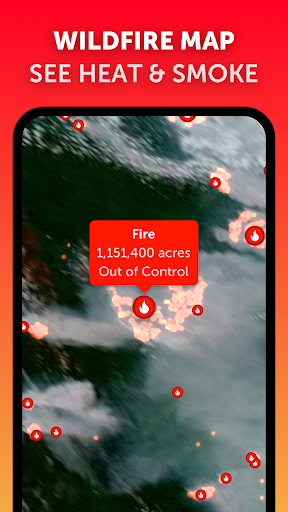
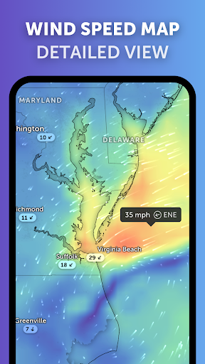
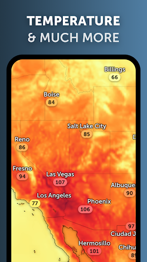
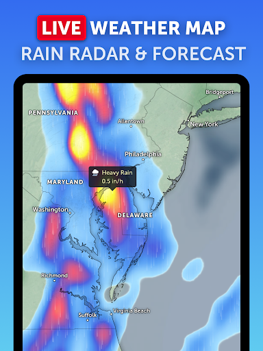
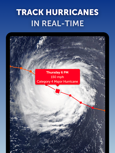
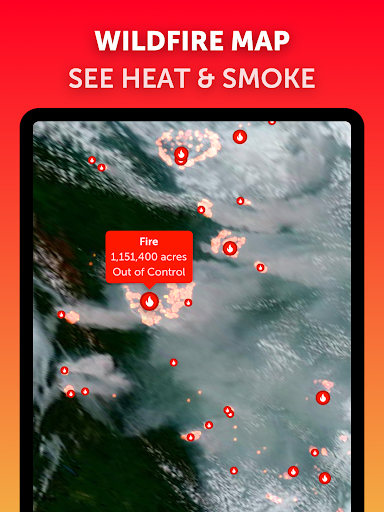
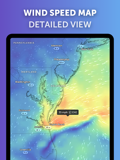
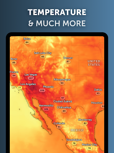
Zoom Earth is an interactive, global weather map that blends near real-time satellite imagery, Doppler rain radar, and continually updated forecast layers (precipitation, wind, gusts, temperature, humidity, pressure, dew point, wet bulb) with hurricane and wildfire tracking. It delivers high-frequency satellite updates, tap-to-inspect local conditions, and customizable units in a clean, map‑first interface.
Verdict
Verdict: A powerful, map‑centric weather app ideal for tracking storms and visualizing global conditions in near real time.
Who is it for
Best for:
- Storm and hurricane watchers who want clear, live tracking
- Map-first weather enthusiasts needing global, detailed layers
- Travelers and professionals (e.g., pilots, coastal residents) who value rapid situational awareness
Not ideal for:
- Users wanting a simple daily widget or hyperlocal hourly cards without map interaction
- Anyone needing full offline access or zero ads without upgrading
Real-world User Experience
Users like it:
Highly praised for frequently updated satellite imagery, accurate storm paths, and a smooth, intuitive interface. Tap-to-location data, measurement tools, hurricane season readiness, and wildfire overlays earn repeated compliments. Performance is noted as reliable with minimal lag.
Users complain about:
Few explicit complaints in reviews; some users wish for home screen widgets and fully ad-free use without subscription. Satellite imagery has a short inherent delay, and advanced features may sit behind the Pro tier.
Is it Worth Paying For?
The free version is robust and sufficient for most users. The optional Pro/IAP is worthwhile for power users who rely on frequent storm tracking, cleaner ad-free visuals, or additional layers—several reviewers report renewing and finding strong value.
How it Compares to Alternatives
Compared to Windy or Ventusky, Zoom Earth emphasizes near real-time satellite and a clean, fast UI with excellent hurricane and wildfire layers. Versus RadarScope/MyRadar, it’s more globally oriented and visually broad (satellite + model layers), though RadarScope remains stronger for pro-grade U.S. radar minutiae. Weather Underground and mainstream apps focus more on local forecasts and widgets; Zoom Earth excels at big-picture situational awareness.
Summary
Zoom Earth - Live Weather Map delivers an exceptional, global, map-first view of weather with near real-time satellite updates, Doppler radar, and a deep set of forecast layers. Its standout hurricane tracking and wildfire monitoring provide timely situational awareness, while tap-to-location data and measurement tools make it practical for both enthusiasts and professionals. Reviews highlight accuracy, speed, and thoughtful design, with only minor wishes for widgets and ad-free access without upgrading. For anyone who prefers visual, interactive weather intelligence—especially during storm season—Zoom Earth is a top-tier choice, with the free version already excellent and the Pro upgrade offering meaningful value.
Ratings
Trending APP


Alternative to this app