Copyright 2026 © swekartor. All Rights Reserved.

App Feature
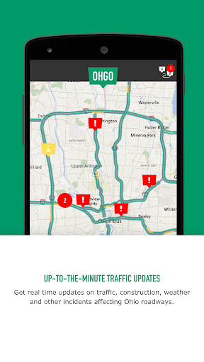
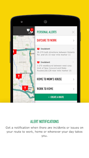
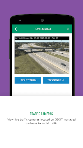
OHGO is the Ohio Department of Transportation’s official app for real-time freeway conditions in Ohio, offering live traffic maps, camera feeds, incident and construction alerts, and customizable notifications to help drivers plan around delays.
Verdict
A useful, Ohio-specific traffic companion with strong data sources, but mixed reliability and polish hold it back.
Who is it for
Best for:
- Ohio commuters who want DOT-sourced incidents, construction, and camera views
- Drivers planning routes around closures or major events on Ohio freeways
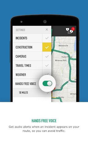
- Travelers who prefer hands-free voice alerts about road conditions
Not ideal for:
- Users seeking turn-by-turn navigation or crowdsourced reports like Waze
- Drivers outside Ohio or those needing multi-state coverage in one app
- Anyone sensitive to app stability issues or inconsistent notifications
Real-world User Experience
Users like it:
Access to official DOT data, live traffic cameras, and real-time freeway conditions is appreciated; customizable alerts and an interactive map help with commute planning.
Users complain about:
Middling ratings suggest reliability issues such as crashes, slow or outdated data in spots, occasional notification inconsistencies, and an interface that can feel clunky compared to mainstream navigation apps.
Is it Worth Paying For?
The app is free with no ads or in-app purchases, so there’s nothing to pay for—its value is solid if you drive Ohio freeways and can tolerate occasional quirks.
How it Compares to Alternatives
Compared to Google Maps and Apple Maps, OHGO offers more granular, DOT-verified incidents, work zones, and camera feeds for Ohio but lacks navigation and broad ecosystem features. Against Waze, it trades crowdsourced, hyper-local reports and rerouting for official data and hands-free alerts. Similar to other state 511 apps, it’s strongest within its jurisdiction and best used alongside a primary navigation app.
Summary
OHGO delivers authoritative, Ohio-focused traffic information with live cameras, incident and construction alerts, speed conditions, and hands-free notifications. It’s a practical complement to your main navigation tool, especially for daily commuters and travelers who rely on accurate, DOT-sourced updates. While its scope is limited to Ohio and user feedback points to uneven reliability and UX polish, the app remains a no-cost way to gain better situational awareness on Ohio’s freeways, helping you avoid delays and plan smarter trips.
Ratings
Trending APP


Alternative to this app