Copyright 2026 © swekartor. All Rights Reserved.


App Feature
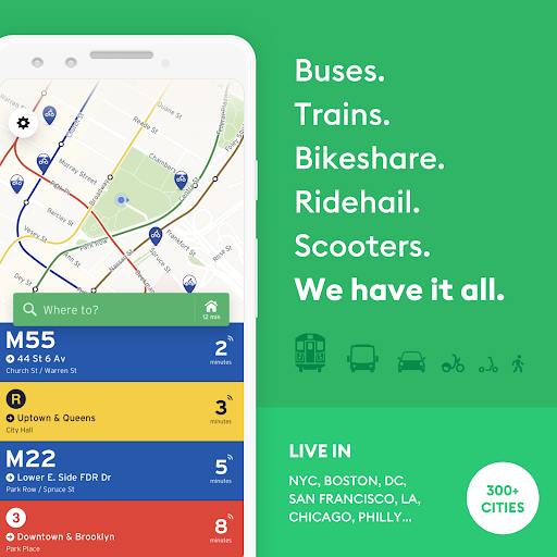
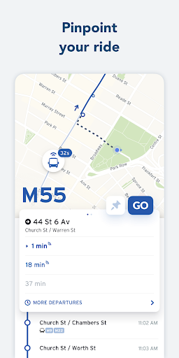
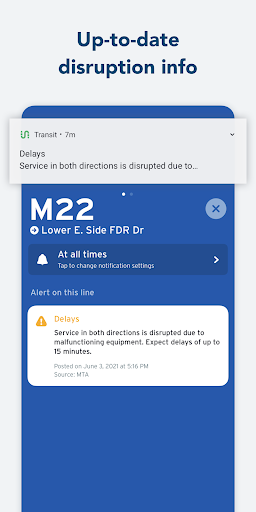
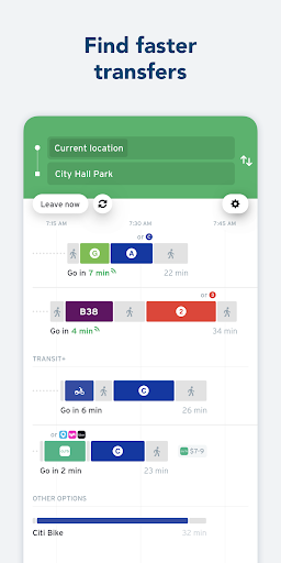
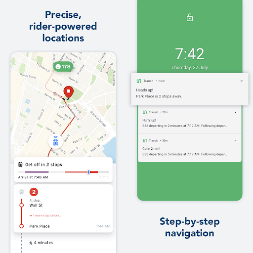
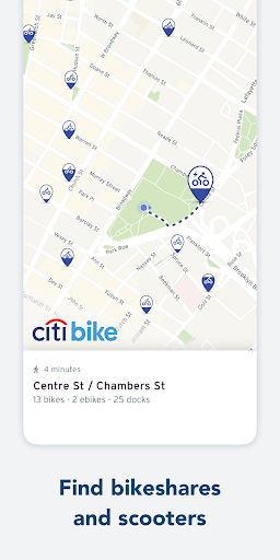
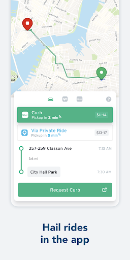
Transit: Bus & Subway Times is a real-time public transit companion for 1,000+ cities that helps you plan multimodal trips, see live vehicle locations and ETAs, receive delay and disruption alerts, navigate with GO guidance (including get-off reminders), save favorites, access offline schedules and maps, and in many cities pay fares or buy bikeshare passes directly in-app.
Verdict
Verdict: A top-tier real-time transit planner with excellent coverage and reliability, best for everyday riders who want accurate ETAs and thoughtful navigation.
Who is it for
Best for:
- Daily commuters and students who need precise, real-time ETAs and alerts
- Riders in large metro areas seeking multimodal trip planning (bus, subway, bike, scooters)
- Accessibility-focused users who benefit from mobility-friendly routing and verbal instructions
Not ideal for:
- People who require a smartwatch companion app for quick glances on the wrist
- Privacy maximalists who dislike persistent last-known location behavior when GPS is off
- Riders in small regions with limited real-time data from local agencies
Real-world User Experience
Users like it:
Highly accurate bus/train arrival times, live tracking, helpful delay warnings, and dynamic rerouting; GO navigation that updates during trips and signals when to get off; strong accessibility features (mobility-friendly routing, verbal instructions); responsive developer support; the ability to pay fares in-app in supported cities; offline schedules/maps that continue to work underground.
Users complain about:
No dedicated Apple/Samsung Watch app; occasional GPS mismatches underground causing progress errors; app can persist last location when phone location is off, making it harder to scout other areas; past pairing/crash issues for a few users (though support appears responsive).
Is it Worth Paying For?
The app is free with in-app purchases (e.g., a roughly $25/year subscription per one user), and the free version covers core features well. Paying is worthwhile if you want to support development and potentially unlock convenience perks, but most riders will find the free tier sufficient.
How it Compares to Alternatives
Compared with Google Maps, Transit generally provides faster, more transit-focused ETAs, clearer real-time vehicle tracking, and better rider-sourced insights. Versus Citymapper, Transit has broader city coverage, deep agency integrations, and strong offline support, while Citymapper may offer more polished UX in select metros. It consolidates features found in individual agency apps (e.g., MTA, MBTA, CTA) into one place, adding cross-agency trip planning and crowdsourced reliability that most single-agency apps lack.
Summary
Transit is a polished, widely trusted transit planner that excels at real-time accuracy and day-to-day usability. Its strengths are clear ETAs, live vehicle tracking, disruption alerts, and GO turn-by-turn guidance—augmented by smart accessibility settings and offline data for when coverage drops. With fare payment in many cities and thoughtful multimodal planning, it replaces several agency apps at once. Drawbacks include the absence of a smartwatch companion app, occasional underground GPS quirks, and a location persistence behavior some users dislike. Given its robust free tier and responsive team, Transit is one of the best all-around choices for navigating buses and subways in major cities.
Ratings
Trending APP


Alternative to this app