Copyright 2026 © swekartor. All Rights Reserved.

App Feature
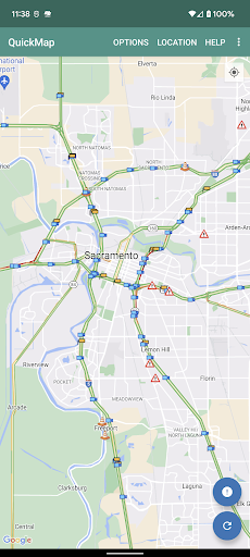
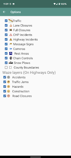
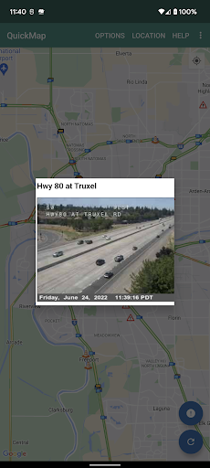
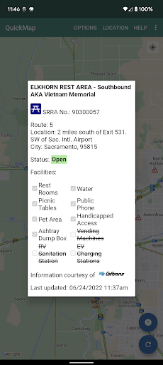
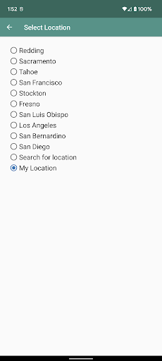
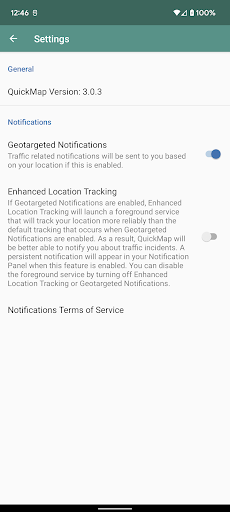
QuickMap provides an official, real-time California traffic map from Caltrans with layers for freeway speed, CHP incidents, lane closures, chain controls, live camera snapshots, changeable message signs, snowplows, rest areas, border wait times, and truck-related infrastructure. You can toggle layers, save preferences, zoom to regions, refresh data, and optionally receive geotargeted closure alerts.
Verdict
Verdict: A reliable, no-frills source for official California road conditions, best as a planning companion rather than a full navigation app.
Who is it for
Best for:
- Drivers needing authoritative Caltrans data (closures, chain controls, cameras).
- Commuters, commercial drivers, and travelers planning routes across California.
Not ideal for:
- Users wanting turn-by-turn navigation and crowd-sourced incident reports.
- Anyone seeking polished UI, rich routing options, or social features.
Real-world User Experience
Users like it:
Accurate, official data refreshed frequently; useful camera snapshots; helpful layers like lane closures and chain controls; simple preference saving; optional geotargeted closure notifications.
Users complain about:
Interface can feel dated and utilitarian; occasional data latency or gaps; limited routing/turn-by-turn features; background location for alerts may impact battery.
Is it Worth Paying For?
The app is free with no ads or in-app purchases, so there’s nothing to pay for—excellent value if you need official California traffic information.
How it Compares to Alternatives
Compared to Google Maps, Apple Maps, or Waze, QuickMap lacks turn-by-turn navigation, ETA routing, and crowd-sourced reports, but it excels at authoritative Caltrans data (closures, chain controls, CMS messages, truck facilities) that third-party apps may not show as comprehensively or as officially. It works best alongside a navigation app rather than replacing one.
Summary
QuickMap is the California Department of Transportation’s straightforward, data-first traffic map. It focuses on delivering official, real-time information—freeway speeds, CHP incidents, lane closures, chain controls, cameras, and more—directly from Caltrans. The utilitarian UI prioritizes clarity over polish, making it ideal for planning and situational awareness, especially for commuters and commercial drivers. While it doesn’t offer turn-by-turn navigation or crowd-sourced insights, its authoritative layers and optional geotargeted closure alerts make it a valuable companion to mainstream navigation apps. Free, ad-free, and reliable, it’s a must-have for anyone regularly driving in California.
Ratings
Trending APP


Alternative to this app