Copyright 2026 © swekartor. All Rights Reserved.
App Feature
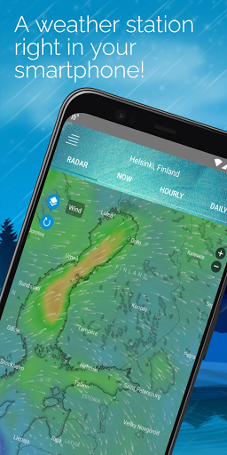
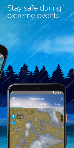
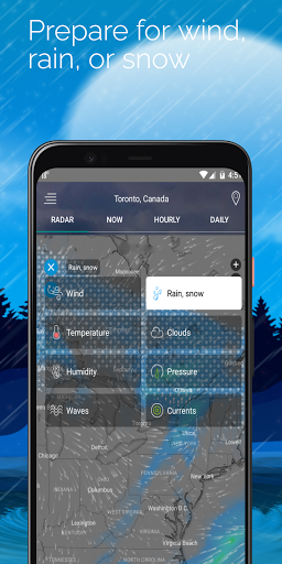
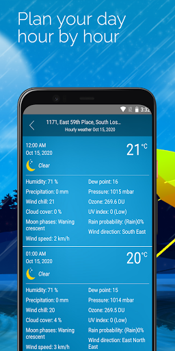
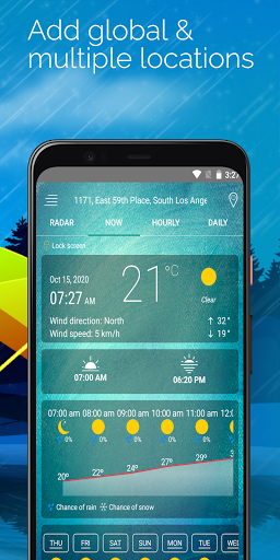
Weather Radar — Live Storm Map delivers live NOAA/NWS radar, hyperlocal nowcasting, and severe weather alerts in a clean, radar-first interface. It layers precipitation, wind, UV, pressure and more on an interactive map, supports multi-location tracking, and offers widgets and customizable notifications for real-time situational awareness.
Verdict
Verdict: A polished, radar-centric weather app that balances rich data with approachable design, best for users who prioritize live storm tracking and timely alerts.
Who is it for
Best for:
- Storm-aware users in severe weather regions needing fast alerts
- Travelers, sailors, pilots, and truckers tracking multiple locations
- Outdoor enthusiasts planning around rain, wind, and UV conditions
Not ideal for:
- Users who need pro-grade, niche layers (e.g., hail, dual-pol) and deep analysis
- Anyone who dislikes learning brief map controls or interpreting color layers
Real-world User Experience
Users like it:
Consistently praised for accuracy, a simple and attractive UI, and robust radar with future playback. Alerts are timely (valuable in Tornado Alley), wind visualization is especially useful for pilots/sailors, multi-city setup helps travelers, and ads are minimal and unobtrusive in the free version.
Users complain about:
Several users want an on-screen legend/color key to clarify radar intensities; some find the lightning overlay cluttered. A few note a learning curve for layer controls and time scrubbing, occasional animation quirks at longer forecast ranges, desire for a hail layer, and requests for a premium trial and longer than 7–14 day outlooks.
Is it Worth Paying For?
Yes for power users: the free tier is fully usable with light ads, but frequent storm trackers may value ad removal and potential advanced features (e.g., more layers/alerts). Casual users can comfortably stay on the free version without feeling hampered.
How it Compares to Alternatives
Compared to MyRadar and The Weather Channel, this app feels more radar-forward with cleaner wind/UV layers and less ad clutter. It’s more approachable than RadarScope (which remains the pro standard for granular radar analysis) and more immediately practical for planning than Windy for most users, while offering a far more modern, readable map than the official NOAA site according to user feedback.
Summary
Weather Radar — Live Storm Map stands out for fast, high-quality radar and practical nowcasting, delivering reliable alerts and clear visuals that help you make day-to-day decisions. Users consistently note its accuracy, helpful wind display, multi-location tracking, and minimal ads. Its main gaps are interpretability (missing always-visible legend), minor overlay clutter, and a learning curve for timeline/layers. If you frequently monitor storms or plan activities around changing conditions, it’s an excellent free pick with a worthwhile upgrade path; professionals needing niche radar products may still prefer specialized tools like RadarScope.
Ratings
Trending APP


Alternative to this app