Copyright 2026 © swekartor. All Rights Reserved.

Information about onX Offroad 4X4 ATV Trail Maps

App Feature
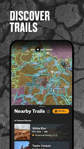
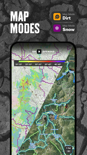
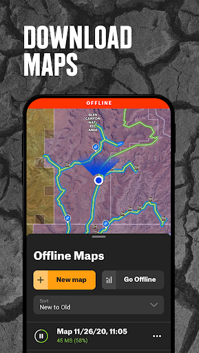
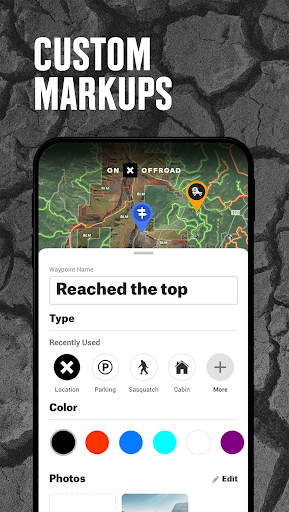
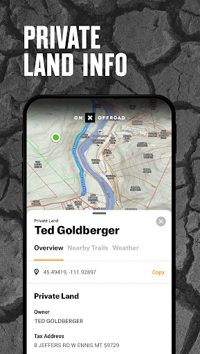
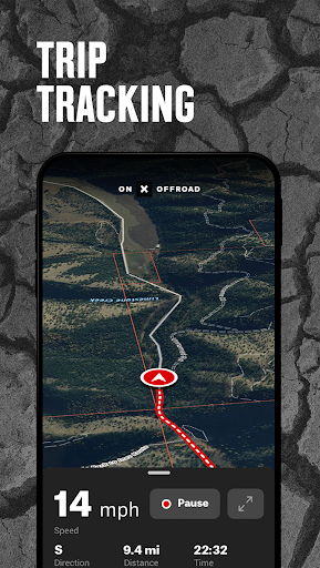
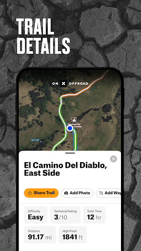
onX Offroad provides off-road GPS navigation with nationwide motorized trail data, offline maps, turn‑by‑turn directions (Android Auto), 3D/topo/satellite layers, difficulty and seasonal status, trip tracking, route building and waypoints, plus public/private land boundaries, dispersed camping overlays, cell coverage and wildfire/smoke layers.
Verdict
Verdict: A powerful, off-road–focused navigator with excellent land/trail data, best for dedicated riders who’ll use its paid layers and planning tools.
Who is it for
Best for:
- 4x4, SxS, ATV, moto and snowmobile riders who need verified trail status and difficulty.
- Overlanders and explorers planning offline, property-aware routes with Android Auto support.
- Users who value desktop-to-mobile planning and detailed land ownership/cell coverage layers.
Not ideal for:
- Casual users who just need generic offline maps without trail-specific data.
- Those wanting rich POIs out of the box or deep customization/analytics without tinkering.
Real-world User Experience
Users like it:
Reliable offline navigation and route planning; large trail catalog with difficulty ratings; desktop route builder syncing to mobile; cumulative travel tracking; frequent data/features updates; responsive support and educational “master classes”; improved landscape mode and added tracking metrics over time.
Users complain about:
Occasional bugs and learning curve (especially prepping offline before no-signal trips); limited POIs compared with some alternatives; desire for more customization (route/marker colors) and once-missing mobile route creation; a few device-specific issues previously in landscape.
Is it Worth Paying For?
Yes for frequent off-roaders: the membership unlocks nationwide public/private land ownership, extensive motorized trail coverage, cell service overlays and other premium layers that materially improve trip planning and legal access. The free trial helps assess coverage in your areas; casual riders who don’t need property data may get by on the free tier or cheaper general-purpose apps.
How it Compares to Alternatives
Compared to Gaia GPS or Avenza, onX Offroad is more purpose-built for motorized trails, with curated difficulty, seasonal status and land ownership baked in; Gaia offers broader backcountry versatility and richer map source customization. Versus AllTrails (hiking-centric), onX is far better for OHV routing. Polaris Ride Command is strong for SxS social features and some trail systems but lacks onX’s nationwide property layers. Google Maps offline is easiest but missing legal access info, trail difficulty and OHV detail. onX’s Android Auto, land boundaries and dispersed camping layer are standout differentiators.
Summary
onX Offroad is a robust, off-road–first navigation app that pairs a deep motorized trail database with land ownership, difficulty and seasonal data, then layers on offline maps, Android Auto, route building and trip tracking. Reviews highlight smooth offline performance, strong planning tools and attentive support, while noting occasional bugs, a desire for more POIs and customization, and a small learning curve around offline prep. If you regularly venture into areas where legal access and property lines matter, the paid membership’s layers and nationwide coverage are worth it; light users can test the free trial and decide based on local trail completeness.
Ratings
Trending APP


Alternative to this app