Copyright 2026 © swekartor. All Rights Reserved.

App Feature
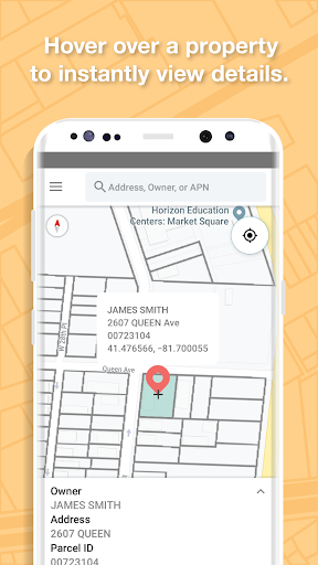
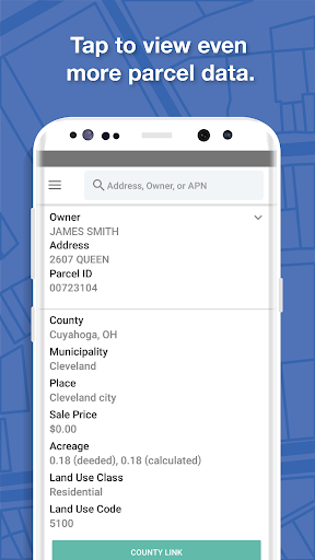
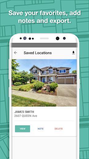
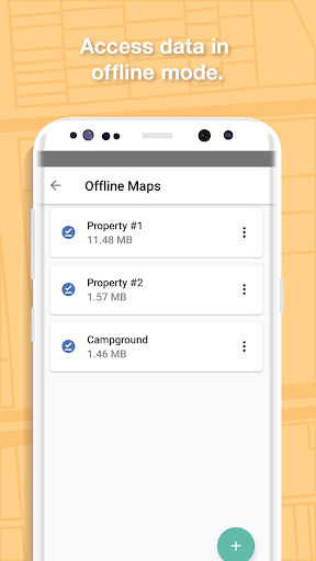
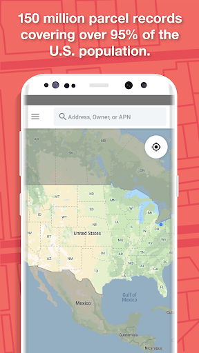
LandGlide is a GPS-enabled property and parcel data app that lets you view parcel boundaries, ownership, acreage, building details, sales history, land use, and more across 160M+ U.S. parcels in 3,200+ counties. You can search by owner, address, or parcel ID, view on-map details by hovering, save pins with notes/photos, work offline with cached areas, and export data.
Verdict
Verdict: A powerful, field-ready parcel data tool with broad U.S. coverage, best for professionals who need quick property insights on the go.
Who is it for
Best for:
- Real estate agents, investors, and land surveyors needing fast parcel ownership and boundary context
- Field researchers and appraisers who value offline access and pins/notes
- Rural property seekers who want county-linked data and sales history at their fingertips
Not ideal for:
- Users seeking live market analytics or MLS-level listing features
- Those who expect survey-grade boundary precision from aerial imagery alone
- Casual users unwilling to pay a recurring subscription after the trial
Real-world User Experience
Users like it:
Professionals report surprisingly accurate GPS-based corner proximity, easy map exploration, and helpful links to county records. The app feels trustworthy (no surprise charges after the trial) and serves as a quick, reliable way to orient to a property in unfamiliar areas.
Users complain about:
Aerial imagery should not be relied upon for exact parcel lines, and county-linked data can be limited depending on the source.
Is it Worth Paying For?
Yes for frequent field use. The 7-day free trial lets you validate coverage and accuracy; at $9.99/month or $99.99/year with no ads, it’s good value for professionals and serious land shoppers who benefit from offline access, pins/notes, and deep attributes. Occasional users may find the subscription unnecessary beyond short projects.
How it Compares to Alternatives
Compared to free county GIS sites, LandGlide offers unified nationwide coverage, mobile GPS positioning, offline access, and standardized attributes in one app. Versus real-estate listing apps (e.g., consumer portals), it focuses on parcel and ownership data rather than listings. Among parcel map apps, its breadth of attributes (building, land, crop, sales history) and large county coverage make it competitive for professional workflows.
Summary
LandGlide delivers a streamlined way to explore U.S. parcel data in the field: open the map, let GPS pinpoint your position, and instantly see ownership, boundaries, acreage, and rich attributes with options to pin, note, and work offline. It shines for surveyors, agents, investors, and researchers who need fast orientation and county-linked facts in unfamiliar areas. While aerial imagery isn’t survey-grade and some county data can be sparse, the app’s reliability, coverage (99% of the U.S. population), and professional-friendly features justify the subscription for regular users. Casual, one-off users may rely on the trial or alternative free sources, but for ongoing property work, LandGlide is a well-regarded, purpose-built tool.
Ratings
Trending APP


Alternative to this app